
Drone Services for Construction
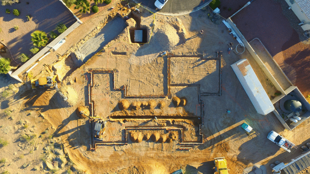
Drones services for construction projects and land development are a useful tool for project management. An experienced drone pilot can perform site surveys, monitor project progress, and collect data for reporting to stakeholders. Multiple flights at specific intervals allow for very useful comparisons from our eye in the sky. Aerial imagery is great for project tracking during all phases of the project from planning to final build to marketing.
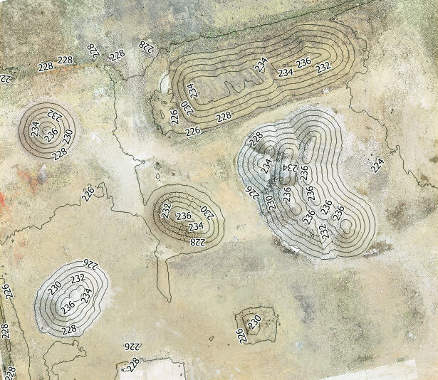
Drone services for construction includes the processing of the collected drone photographs with drone mapping software. This software uses the collected images to quickly create high resolution orthomosaic, elevation, 3D models, and high resolution Google Earth overlays. Cloud based maps make sharing and collaborating with stakeholders very convenient.
Aerial Intelligence for Construction Sites
- Pre-construction site planning and design
- Weekly updated mapping of construction site
- Easily communicate project progress at any stage
- Document and share a visual timeline to stakeholders
- Streamline decision making with a visual context of site conditions
- Evaluate site conditions with built-in measurement tools
- Compare actual conditions to pre-construction or final plans
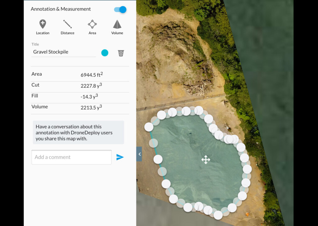
- Stockpile volume measurements
For an example of stockpile volume measurements, click on the link below to go to a orthomosaic map that was created from aerial photos and overlaid in Google Earth. The stockpiles are outlined. Left click on the outline to see the volume and area measurement.
https://www.mapsmadeeasy.com/maps/public/862141bc74a24fefb3ff05fd07dcc623/
Drone Services for Construction Pricing
Contact us for an estimate.
- High-definition photos and mapping
- Measure stockpile volumes
- Deliverables include .jpg, .GeoTIFF, .kmz files, and .pdf
- Ground Control Points are available upon request at an extra cost or can be provided to us.
- Additional post-processing and data calculations
- Same location may be photographed, filmed, or mapped at regular time intervals to compare progress
Please contact us to discuss what we may do for your project.